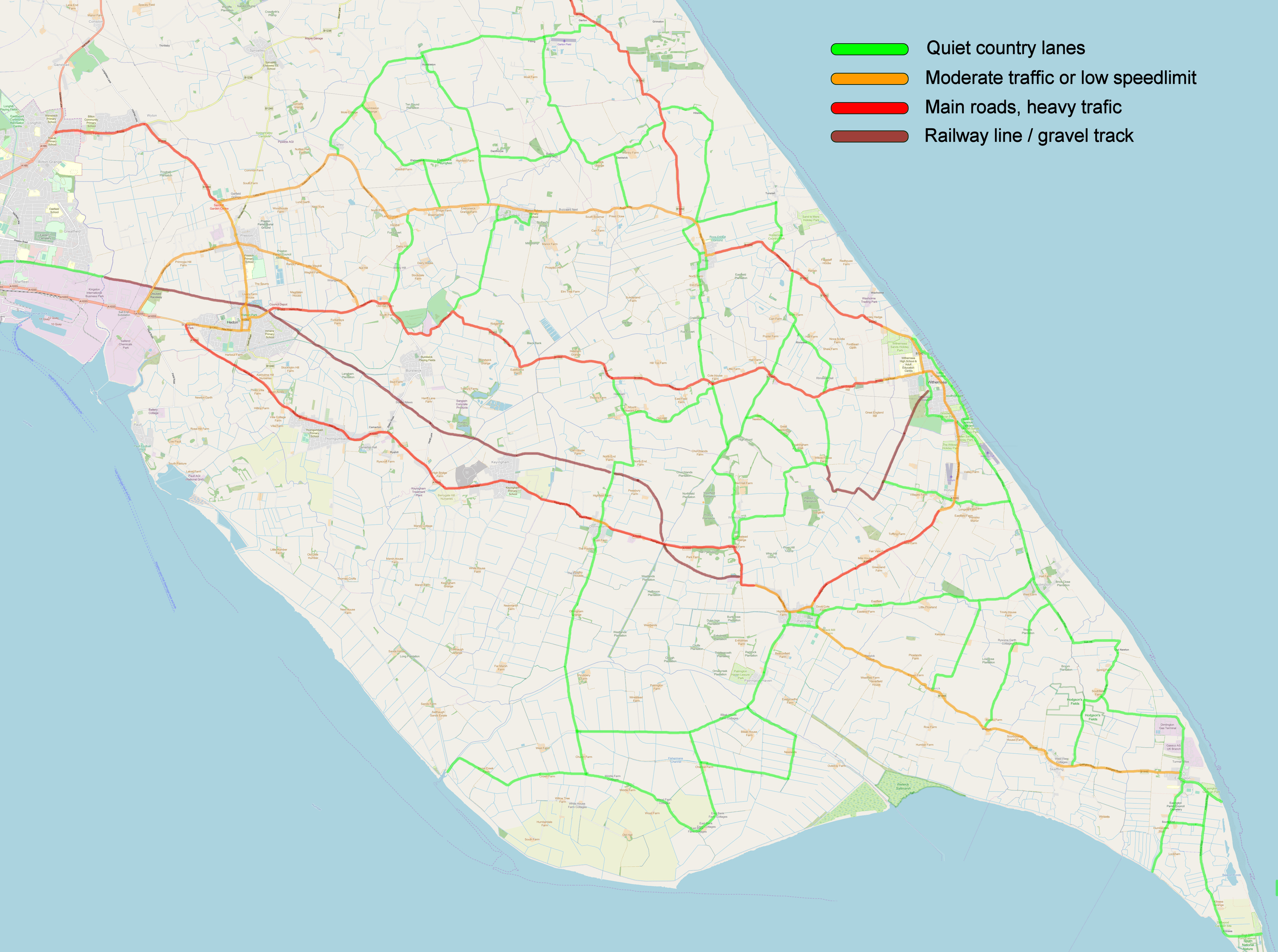
There's nothing like the great outdoors, and the beauty of this area is that it has miles of country lanes winding through the open landscape. Leave the car behind, and get out on foot or bike to explore the area with its wide open skies and friendly people. Take the time to see the views and capture the moments that get lost when you travel by car. Remember to stick to the tracks and footpaths, take a map, a phone and a drink. There are plenty of routes in the area. Below are some suggestions to get you started.
Click on the following links for suggested routes around Withernsea and from Withernsea to a number of destination.
Street Map of Withernsea (July 2018)
Withernsea Fish Trail (October 2020)
Town Circular Walk 1, 1 3/4 miles, 2.9km (July 2018)
Town Circular Walk 2, 3 miles, 4.8km (July 2019)
Fields and old railway tracks, 2 1/2 miles, 4.0km (August 2018)
The K9 Walk, 3 miles, 4.5 km (July 2019)
Withernsea-Holym-Railway Tracks, 4.5 miles, 7 km
Withernsea-Frodingham Lane- Railway Tracks, 5.5 miles, 9 km
Withernsea to Sand-Le-Mere, 7 miles, 11km
Withernsea-Winestead-Patrington-Holmpton, 13 miles, 21km (Sep 2019)
Withernsea-Welwick Saltmarsh 16 miles / 26 km
Withernsea-Spurn 22.4 miles / 36 km
Withernsea-Tunstall-Hilston-Owstwick-Danthorpe-Burstwick-Halsham-Frodingham 22.7 miles / 36 km
Withernsea-Stone Creek 23.5 miles / 38 km
Withernsea-Tunstall-Hilston-Garton-Lelley-Burton Pidsey-Halsham, 25.7 Miles, 41km
Withernsea-Roos-Danthorp-Humbleton-Burton Constable-Sproatley-Lelley-Burstwick, 29.3 Miles, 47km
Withernsea-Hull City Centre 38.6 miles / 62 km round trip
Withernsea-Beverley 57 miles / 92 km round trip